
atlas
Atlas is the name, in Greek mythology, of the giant holding the Land and the firmament on his shoulders. Son of Iapetus Y Climene, Atlas is a titan who was condemned to carry the planet for Zeus.
The term has many uses today. By extension to the mythological concept, atlas is the name of the first cervical vertebra, which is in direct contact with the occipital bone and immediately supports the head.
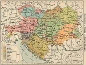
Another very frequent use of atlases is in reference to the collection of maps (geographical, historical or otherwise) that are compiled in the same volume. The atlases, according to their contents, can be national, regional or universal. For example: "When I was a boy, I was fascinated by looking at the atlas maps that my grandfather had in his library", "I'm going to the library to find an atlas: I have to consult a map of the Roman Empire", "Miguel is trying to find the town where we will go on vacation in the atlas".
The notion of an atlas is common in astronomy. This is the name given to a family of American rockets, a Moon of the planet Saturn and a space observatory of the POT which is in the study phase.
The club Gualadajara Atlas is a Mexican soccer team that competes in the tournament of First division. Champion was enshrined in 1950-1951 and won several editions of the Mexico Cup.
Charles Atlas (1892-1972), finally, he was a bodybuilder who invented a popular bodybuilding method that bears his name.
From print to Google Maps
Until the early 1990s, the word atlas was associated with books In print, a perfect companion to an encyclopedia, a large volume that dazzled its readers with its impressive full-color maps full of interesting and unusual information from all over the world. For those who did not have one at home, there were libraries; the lucky ones, on the other hand, surely reserved a special place on their bookshelf for this source of world knowledge.
With the arrival of the Encarta Encyclopedia, of Microsoft, little by little the use of the books of consultation in physical format was decreasing, and its World Atlas left millions of users speechless at the possibility of freely manipulating a digital globe, to intuitively find the point on the map they would like to explore and, once found, approach it, seeing with the typical amazement of the it was pre-smartphone how a planisphere map was gradually transformed into a local one.
Just as the immense popularity of Wikipedia helped the public lose interest in Encarta until Microsoft discontinued it, the omnipresent Google Maps became a kind of atlas that a large percentage of the world's population consults on a daily basis as part of their virtual tasks. However, it was not until March 2014 that Google converted this powerful service in an atlas officially.
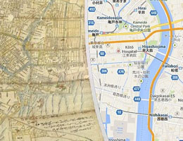
The atlas of Google Maps allows its users to apply layers in the maps to study population statistics, the changes that have undergone the temperatures around the world in a given period, historical maps of various cities and the consequences of deforestation. All this, accompanied by descriptions and the possibility of acquiring copies in physical format of the various maps. Among the companies that collaborate with this project is none other than National Geographic.
Even for many defenders of traditional literature, printed on paper and protected by strong and tangible covers, it is fascinating to observe an animated capture of the Earth at night, with the twinkling lights of its cities, or a flat Tokyo in the seventeenth century to compare it with today.
Leave a Reply